Intersection

Search for intersections in NYC

Intersection Search - findAddressCandidates

You can search for many different kinds of addresses using the LocateNYC API /findAddressCandidates operation including address, place, intersection, NYC building (using BIN), NYC tax lot (using BBL), 3D building floor, street segment (the street between two consecutive intersections), street segment blockface (one side of the street), and street stretch (the stretch of street between intersections that are not consecutive). You can pass the address components in a single parameter using the singleLine option or separtated into multiple parameters. The response is the same for both scenarios.

This page focuses on searching for intersections, which is when two (or more) streets cross one another. For a discusson of address and place search please see the Address Search page.

LocateNYC returns a wide variety of response parameters. Please see the Response Parameters sections below for a full list. Many of these parameters are derived directly for the NYC Geosupport API and are described using the descriptions provided in the Geosupport User Programming Guide (UPG). Many other parameters are created directly from the LocateNYC API and are also descirbed in Repsonse Parameters section.


Helpful Documentation Links


Contents


Request URL

GET/POST https://locatenyc.io/arcgis/rest/services/locateNYC/v1/GeocodeServer/findAddressCandidates


Parameters

Required Parameters

token

JSON web token (JWT). An encoded token used to authenticate the user. Can be obtained by making a request to the /tokens/generateToken operation.

Optional Parameters

singleLine

Specifies the location to be geocoded. The input address components are formatted as a single string.

Address Example:
singleLine=231 East 10th Street, Manhattan

Place Example:
singleLine=Carnegie Hall

BIN Example:
singleLine=1006458

BBL Example:
singleLine=1007810001

Intersection Example:
singleLine=8th Avenue and 41st Street, Manhattan

Street Segment Example:
singleLine=10th Ave between W 50 St and W 51 St, Manhattan

Blockface Example:
singleLine=West side of 10th Ave between W 50 St and W 51 St, Manhattan

3D Address Example:
singleLine=231 East 10th Street, Manhattan, Floor 3

3D Place (the "B" represents below ground or basement) Example:
singleLine=Carnegie Hall, Floor B1


houseNumber

The number of the address to be geocoded. To be used in coordination with street, borough, zip


street

The street name of the address to be geocoded. To be used with houseNumber, borough, zip


borough

The borough of the address to be geocoded. Accepts both spelled and coded values. Accepts [Manhattan, Bronx, Brooklyn, Queens, Staten Island, MN, BR, BK, QN, SI, 1, 2, 3, 4, 5] as well as coded values for boroughs. See BOROUGH CODE for more details on the coded values. To be used with houseNumber, street, zip

Example:

borough=Manhattan


zip

The zip code (postal) of the address to be geocoded. 5 bytes. To be used with houseNumber, street, borough

Example:

zip=10035


onStreet

The "on" street segment/stretch for street segment/blockface queries. For example, the address is "on" W 41 St between 7 Ave and 8 Ave. If passed to the API, crossStreetOne and crossStreetTwo are required.

Example:

onStreet=West 41 Street


crossStreetOne

The first cross street for street segment/blockface queries. For example, the address is "on" W 41 St between 7 Ave and 8 Ave. If passed to the API, onStreet and crossStreetTwo are required.

Example:

crossStreetOne=7 Ave


crossStreetTwo

The first cross street for street/segment blockface queries. For example, the address is "on" W 41 St between 7 Ave and 8 Ave. If passed to the API, onStreet and crossStreetOne are required.

Example:

crossStreetTwo=8 Ave


compassDirection

The compass direction [n, s, e, w] for single side blockface queries. If the LocateNYC API finds a match, then Geosupport blockface information (only one side of a street segment) will be returned. If passed to the API, onStreet , crossStreetOne, and crossStreetTwo are required.

Example:

compassDirection=e


boroughCrossStreetOne

The borough of the first cross street (crossStreetOne) for street segment/blockface queries. Only required if crossStreetOne parameter is passed.

Example:

boroughCrossStreetOne=manhattan


boroughCrossStreetTwo

The borough of the second cross street (crossStreetTwo) for street segment/blockface queries. Only required if crossStreetTwo parameter is passed.

Example:

boroughCrossStreetTwo=manhattan


outSR

The well-known ID of the spatial reference, or a spatial reference JSON object for the returned addresses. WKID accepted include: [4326 (default, WGS), 2263 (Long Island State Plane), 3857 (Web Mercator), 102100 (Web Mercator), 26918 (UTM 18N)]. Format 1; 3857. Format 2; {"wkid":102100}.

Examples:

outSR=3857


outSR={"wkid":102100}


normalizeType

The normalize type parameter represents how the address should be normalized by LocateNYC/Geosupport. For more details, please refer to the Geosupport User Guide The supported types are


callback

Callback parameter. Produces padded JSON response. Used by Esri APIs/SDKs. Only use this if you really know what your doing.


f

Requested format of the response. Only accepts 'json', and the default value is 'json'.


findAddressCandidates Details

GET/POST https://locatenyc.io/arcgis/rest/services/locateNYC/v1/GeocodeServer/findAddressCandidates

Search for Intersections

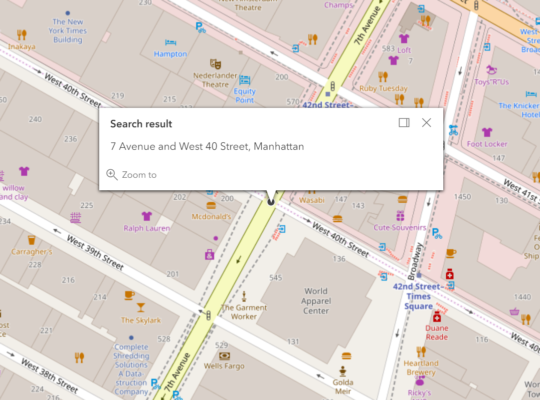
An intersection is where two (or more) streets cross one another. An intersection search consists of providing the first and second cross streets, along with an a borough name. For example, 7th avenue and west 40th street, manhattan or using the ampersand symbol 7th avenue & west 40th street, manhattan

Example: Search for an intersection

 Request


    Or, multiline


 Response

{
  "spatialReference": {
    "wkid": 102100,
    "latestWkid": 3857
  },
  "candidates": [
    {
      "address": "7 Avenue and West 40 Street, Manhattan",
      "location": {
        "x": -8236294.285189754,
        "y": 4976234.087802257
      },
      "score": 100,
      "attributes": {
        "assemblyDistrict": "75",
        "boroughCode1In": "1",
        "censusTract1990": " 113  ",
        "censusTract2000": " 113  ",
        "censusTract2010": " 113  ",
        "cityCouncilDistrict": "03",
        "civilCourtDistrict": "09",
        "communityDistrict": "105",
        "communityDistrictBoroughCode": "1",
        "communityDistrictNumber": "05",
        "communitySchoolDistrict": "02",
        "congressionalDistrict": "12",
        "crossStreetNamesFlagIn": "E",
        "dcpPreferredLgcForStreet1": "04",
        "dcpPreferredLgcForStreet2": "01",
        "dotStreetLightContractorArea": "1",
        "fireBattalion": "07",
        "fireCompanyNumber": "026",
        "fireCompanyType": "E",
        "fireDivision": "01",
        "firstBoroughName": "MANHATTAN",
        "firstStreetCode": "11061004010",
        "firstStreetNameNormalized": "7 AVENUE",
        "geosupportFunctionCode": "2",
        "geosupportReturnCode": "00",
        "healthArea": "5200",
        "healthCenterDistrict": "15",
        "instructionalRegion": "MS",
        "interimAssistanceEligibilityIndicator": "I",
        "intersectingStreet1": "110610",
        "intersectingStreet2": "134570",
        "latitude": 40.75474808558302,
        "lionNodeNumber": "0021404",
        "listOfPairsOfLevelCodes": "MMMM",
        "longitude": -73.98789040892225,
        "numberOfIntersectingStreets": "2",
        "numberOfStreetCodesAndNamesInList": "02",
        "policePatrolBoroughCommand": "1",
        "policePrecinct": "014",
        "sanbornBoroughCode1": "1",
        "sanbornBoroughCode2": "1",
        "sanbornPageNumber1": "034",
        "sanbornPageNumber2": "036",
        "sanbornVolumeNumber1": "05",
        "sanbornVolumeNumber2": "05",
        "sanbornVolumeNumberSuffix1": "N",
        "sanbornVolumeNumberSuffix2": "N",
        "sanitationCollectionSchedulingSectionAndSubsection": "1H",
        "sanitationDistrict": "105",
        "sanitationSection": "151",
        "secondStreetCode": "13457001010",
        "secondStreetNameNormalized": "WEST   40 STREET",
        "stateSenatorialDistrict": "27",
        "streetCode1": "11061004",
        "streetCode2": "13457001",
        "streetName1": "7 AVENUE",
        "streetName1In": "7TH AVENUE",
        "streetName2": "WEST   40 STREET",
        "streetName2In": "WEST 40TH STREET",
        "workAreaFormatIndicatorIn": "C",
        "xCoordinate": "0987605",
        "yCoordinate": "0214252",
        "zipCode": "10018",
        "Loc_name": "geosupport_2",
        "Addr_type": "PointAddress",
        "Score": 100,
        "Match_addr": "7 Avenue and West 40 Street, Manhattan",
        "geoclient_function": "INTERSECTION",
        "geoclient_version": "2.0.0",
        "geosupport_release": "19a",
        "geosupport_release_date": "February 2019",
        "geosupport_version": "19.1",
        "status": "EXACT_MATCH",
        "level": "0"
      }
    }
  ]
}

 Map

Search for Intersection of Dead End Streets (psuedo-intersection)

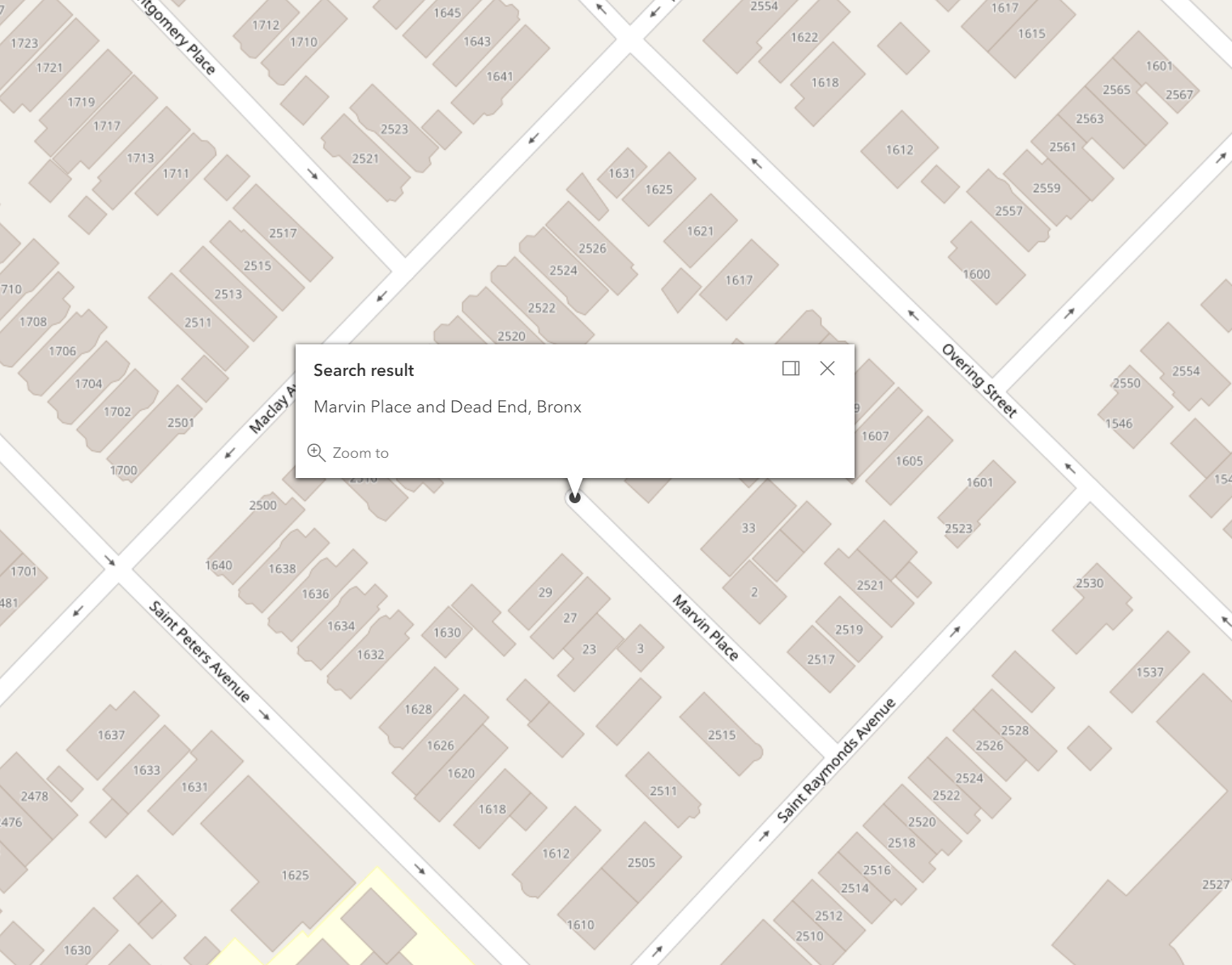
A dead end psuedo-intersection is a street that has a termination point that is not at a city limit and at which there are no cross streets. "Dead End" should be used as the second cross street.

Example: Search for an intersection on a dead end street (e.g. cul-de-sac, or dead end street). Marvin Place and Dead End, Bronx

 Request


    Or, multiline


 Response

{
  "spatialReference": {
    "wkid": 102100,
    "latestWkid": 3857
  },
  "candidates": [
    {
      "address": "Marvin Place and Dead End, Bronx",
      "location": {
        "x": -8220719.370363242,
        "y": 4989023.288442491
      },
      "score": 100,
      "attributes": {
        "assemblyDistrict": "82",
        "boroughCode1In": "2",
        "censusTract1990": " 198  ",
        "censusTract2000": " 198  ",
        "censusTract2010": " 200  ",
        "cityCouncilDistrict": "13",
        "civilCourtDistrict": "01",
        "communityDistrict": "210",
        "communityDistrictBoroughCode": "2",
        "communityDistrictNumber": "10",
        "communitySchoolDistrict": "11",
        "congressionalDistrict": "14",
        "crossStreetNamesFlagIn": "E",
        "dcpPreferredLgcForStreet1": "01",
        "dcpPreferredLgcForStreet2": "01",
        "dotStreetLightContractorArea": "X",
        "fireBattalion": "20",
        "fireCompanyNumber": "050",
        "fireCompanyType": "L",
        "fireDivision": "07",
        "firstBoroughName": "BRONX",
        "firstStreetCode": "24965001010",
        "firstStreetNameNormalized": "MARVIN PLACE",
        "geosupportFunctionCode": "2",
        "geosupportReturnCode": "00",
        "healthArea": "1320",
        "healthCenterDistrict": "26",
        "instructionalRegion": "BX",
        "interimAssistanceEligibilityIndicator": "E",
        "intersectingStreet1": "223800",
        "intersectingStreet2": "249650",
        "latitude": 40.841719530257876,
        "lionNodeNumber": "0052967",
        "listOfPairsOfLevelCodes": "M",
        "longitude": -73.84797856854709,
        "numberOfIntersectingStreets": "2",
        "numberOfStreetCodesAndNamesInList": "02",
        "policePatrolBoroughCommand": "3",
        "policePrecinct": "045",
        "sanbornBoroughCode1": "2",
        "sanbornPageNumber1": "020",
        "sanbornVolumeNumber1": "19",
        "sanitationCollectionSchedulingSectionAndSubsection": "1E",
        "sanitationDistrict": "210",
        "sanitationSection": "262",
        "secondStreetCode": "22380001010",
        "secondStreetNameNormalized": "DEAD END",
        "stateSenatorialDistrict": "32",
        "streetCode1": "22380001",
        "streetCode2": "24965001",
        "streetName1": "DEAD END",
        "streetName1In": "MARVIN PLACE",
        "streetName2": "MARVIN PLACE",
        "streetName2In": "DEAD END",
        "workAreaFormatIndicatorIn": "C",
        "xCoordinate": "1026313",
        "yCoordinate": "0245975",
        "zipCode": "10461",
        "Loc_name": "geosupport_2",
        "Addr_type": "PointAddress",
        "Score": 100,
        "Match_addr": "Marvin Place and Dead End, Bronx",
        "geoclient_function": "INTERSECTION",
        "geoclient_version": "2.0.0",
        "geosupport_release": "19a",
        "geosupport_release_date": "February 2019",
        "geosupport_version": "19.1",
        "status": "EXACT_MATCH",
        "level": "0"
      }
    }
  ]
}

 Map

Search for Intersection with City Limit (psuedo-intersection)

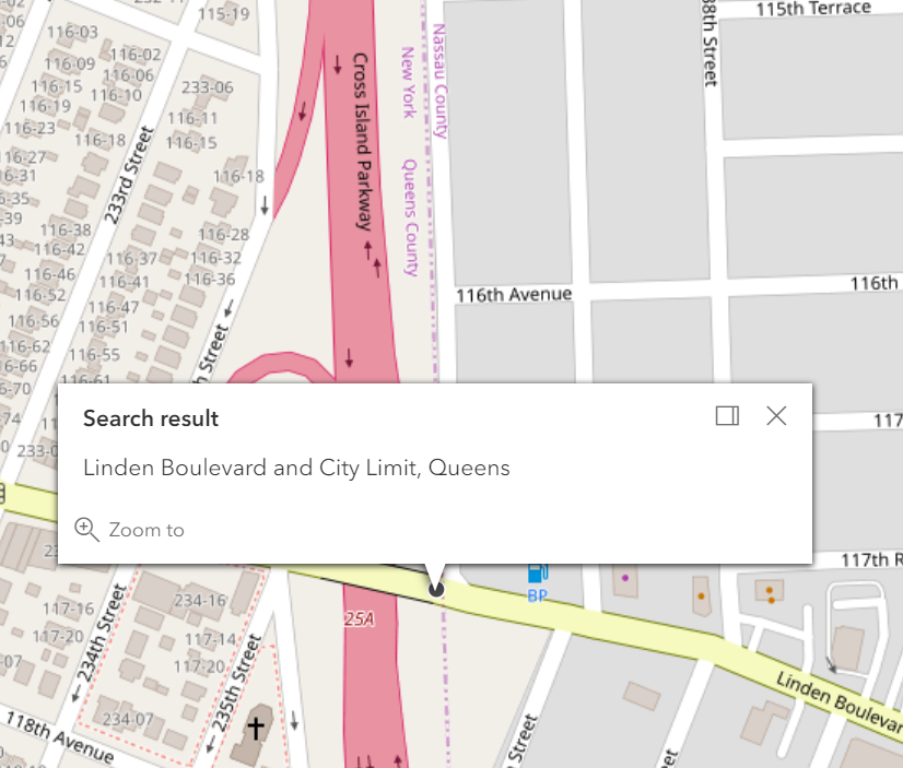
A city limit psuedo-intersection is where the street (or non-street feature e.g. bridge or tunnel) intersects with the NYC city limits. (The street may terminate at that point or it may continue as a suburban street). City Limit points occur at the Bronx- Westchester County border, the Queens-Nassau County border, the New York-New Jersey border and the Staten Island –New Jersey border. 
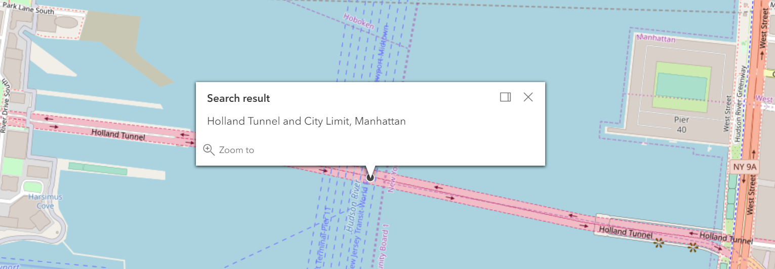
The New Jersey borders occur in the Hudson River, for example HOLLAND TUNNEL and CITY LIMIT in Manhattan. "City Limit" should be used as the second cross street (even though it doesn't exist).

Example: Search for an intersection with the city limit. Linden Boulevard and City Limit, Queens

 Request


    Or, multiline


 Response

{
  "spatialReference": {
    "wkid": 102100,
    "latestWkid": 3857
  },
  "candidates": [
    {
      "address": "Linden Boulevard and City Limit, Queens",
      "location": {
        "x": -8207169.48875227,
        "y": 4966813.300969773
      },
      "score": 100,
      "attributes": {
        "assemblyDistrict": "33",
        "boroughCode1In": "4",
        "censusTract1990": " 602  ",
        "censusTract2000": " 602  ",
        "censusTract2010": " 622  ",
        "cityCouncilDistrict": "27",
        "civilCourtDistrict": "04",
        "communityDistrict": "413",
        "communityDistrictBoroughCode": "4",
        "communityDistrictNumber": "13",
        "communitySchoolDistrict": "29",
        "congressionalDistrict": "05",
        "crossStreetNamesFlagIn": "E",
        "dcpPreferredLgcForStreet1": "01",
        "dcpPreferredLgcForStreet2": "01",
        "dotStreetLightContractorArea": "4",
        "fireBattalion": "54",
        "fireCompanyNumber": "165",
        "fireCompanyType": "L",
        "fireDivision": "13",
        "firstBoroughName": "QUEENS",
        "firstStreetCode": "45389001010",
        "firstStreetNameNormalized": "LINDEN BOULEVARD",
        "geosupportFunctionCode": "2",
        "geosupportReturnCode": "00",
        "healthArea": "2920",
        "healthCenterDistrict": "44",
        "instructionalRegion": "QS",
        "interimAssistanceEligibilityIndicator": "I",
        "intersectingStreet1": "439024",
        "intersectingStreet2": "453890",
        "intersectingStreet3": "413185",
        "latitude": 40.69061027140447,
        "lionNodeNumber": "0040522",
        "listOfPairsOfLevelCodes": "**M",
        "longitude": -73.72625791105563,
        "numberOfIntersectingStreets": "3",
        "numberOfStreetCodesAndNamesInList": "03",
        "policePatrolBoroughCommand": "8",
        "policePrecinct": "105",
        "sanbornBoroughCode1": "4",
        "sanbornPageNumber1": "103",
        "sanbornVolumeNumber1": "13",
        "sanitationDistrict": "413",
        "sanitationSection": "444",
        "secondStreetCode": "43902401010",
        "secondStreetNameNormalized": "CITY LIMIT",
        "stateSenatorialDistrict": "14",
        "streetCode1": "43902401",
        "streetCode2": "45389001",
        "streetCode3": "41318501",
        "streetName1": "CITY LIMIT",
        "streetName1In": "LINDEN BOULEVARD",
        "streetName2": "LINDEN BOULEVARD",
        "streetName2In": "CITY LIMIT",
        "streetName3": "BOROUGH BOUNDARY",
        "workAreaFormatIndicatorIn": "C",
        "xCoordinate": "1060164",
        "yCoordinate": "0191003",
        "zipCode": "11411",
        "Loc_name": "geosupport_2",
        "Addr_type": "PointAddress",
        "Score": 100,
        "Match_addr": "Linden Boulevard and City Limit, Queens",
        "geoclient_function": "INTERSECTION",
        "geoclient_version": "2.0.0",
        "geosupport_release": "19a",
        "geosupport_release_date": "February 2019",
        "geosupport_version": "19.1",
        "status": "EXACT_MATCH",
        "level": "0"
      }
    }
  ]
}

 Map

 Explanation


The map above shows the intersection of Linden Boulevard in Queens intesecting with the Queens County - Nassau County line. Linden Boulevard does not terminate at the county line, instead it continues into Nassau County, NY.

Example: Search for an intersection with the city limit. Holland Tunnel and City Limit

 Request


    Or, multiline


 Response

{
  "spatialReference": {
    "wkid": 102100,
    "latestWkid": 3857
  },
  "candidates": [
    {
      "address": "Holland Tunnel and City Limit, Manhattan",
      "location": {
        "x": -8240036.461592175,
        "y": 4972239.49120785
      },
      "score": 90,
      "attributes": {
        "assemblyDistrict": "66",
        "boroughCode1In": "1",
        "censusTract1990": " 31702",
        "censusTract2000": " 31702",
        "censusTract2010": "  37  ",
        "cityCouncilDistrict": "03",
        "civilCourtDistrict": "00",
        "communityDistrict": "101",
        "communityDistrictBoroughCode": "1",
        "communityDistrictNumber": "01",
        "congressionalDistrict": "10",
        "crossStreetNamesFlagIn": "E",
        "dcpPreferredLgcForStreet1": "01",
        "dcpPreferredLgcForStreet2": "01",
        "dotStreetLightContractorArea": "1",
        "firstBoroughName": "MANHATTAN",
        "firstStreetCode": "19743001010",
        "firstStreetNameNormalized": "HOLLAND TUNNEL",
        "geosupportFunctionCode": "2",
        "geosupportReturnCode": "00",
        "healthArea": "6800",
        "healthCenterDistrict": "15",
        "instructionalRegion": "MS",
        "interimAssistanceEligibilityIndicator": "I",
        "intersectingStreet1": "100107",
        "intersectingStreet2": "197430",
        "intersectingStreet3": "111450",
        "latitude": 40.72755995387209,
        "lionNodeNumber": "0019962",
        "listOfPairsOfLevelCodes": "***",
        "longitude": -74.02150695150391,
        "numberOfIntersectingStreets": "3",
        "numberOfStreetCodesAndNamesInList": "03",
        "policePatrolBoroughCommand": "1",
        "policePrecinct": "001",
        "sanitationDistrict": "101",
        "sanitationSection": "151",
        "secondStreetCode": "10010701010",
        "secondStreetNameNormalized": "CITY LIMIT",
        "stateSenatorialDistrict": "26",
        "streetCode1": "10010701",
        "streetCode2": "19743001",
        "streetCode3": "11145001",
        "streetName1": "CITY LIMIT",
        "streetName1In": "HOLLAND TUNNEL",
        "streetName2": "HOLLAND TUNNEL",
        "streetName2In": "CITY LIMIT",
        "streetName3": "BOROUGH BOUNDARY",
        "workAreaFormatIndicatorIn": "C",
        "xCoordinate": "0978289",
        "yCoordinate": "0204347",
        "zipCode": "10013",
        "Loc_name": "geosupport_2",
        "Addr_type": "PointAddress",
        "Score": 90,
        "Match_addr": "Holland Tunnel and City Limit, Manhattan",
        "geoclient_function": "INTERSECTION",
        "geoclient_version": "2.0.0",
        "geosupport_release": "19a",
        "geosupport_release_date": "February 2019",
        "geosupport_version": "19.1",
        "status": "POSSIBLE_MATCH",
        "level": "1"
      }
    }
  ]
}

 Map

 Explanation


The map above shows the intersection of the Holland Tunnel and the NY/NJ border which occurs in the middle of the Hudson River.

Search for Intersection with Street Bend (psuedo-intersection)

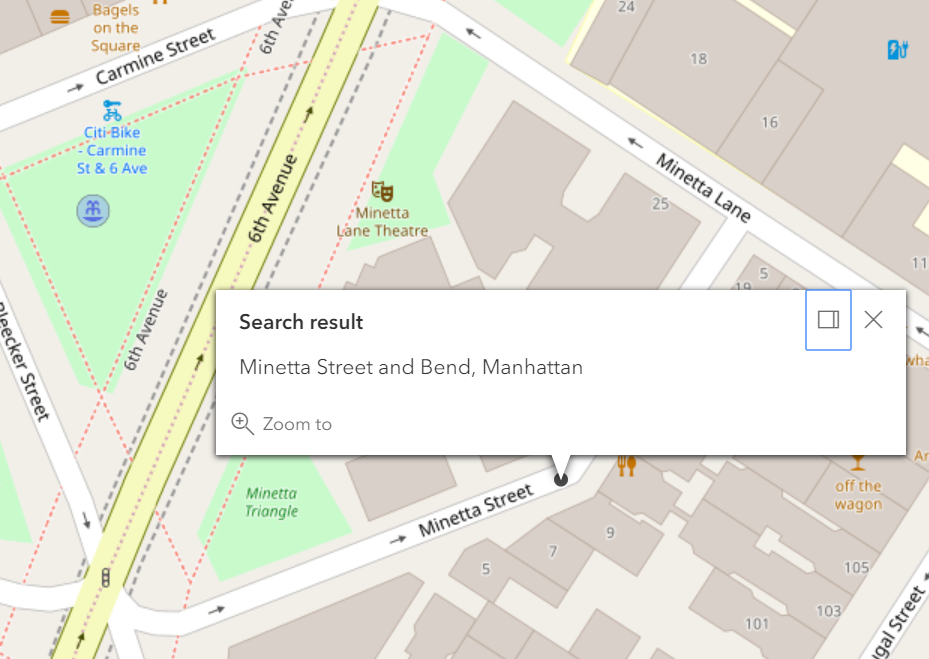
A bend in a street segment is considered as a bend point if the angle of the bend is greater than a 20°. Bend points are considered psuedo-intersections because there is technically no second cross street in reality. "Bend" should be used as the second cross street.

Example: Search for a psuedo-intersection with the bend. Minetta Street and Bend, Manhattan

 Request


    Or, multiline


 Response

{
  "spatialReference": {
    "wkid": 102100,
    "latestWkid": 3857
  },
  "candidates": [
    {
      "address": "Minetta Street and Bend, Manhattan",
      "location": {
        "x": -8237792.1335773915,
        "y": 4972581.29204656
      },
      "score": 100,
      "attributes": {
        "assemblyDistrict": "66",
        "boroughCode1In": "1",
        "censusTract1990": "  65  ",
        "censusTract2000": "  65  ",
        "censusTract2010": "  65  ",
        "cityCouncilDistrict": "01",
        "civilCourtDistrict": "02",
        "communityDistrict": "102",
        "communityDistrictBoroughCode": "1",
        "communityDistrictNumber": "02",
        "communitySchoolDistrict": "02",
        "congressionalDistrict": "10",
        "crossStreetNamesFlagIn": "E",
        "dcpPreferredLgcForStreet1": "01",
        "dcpPreferredLgcForStreet2": "01",
        "dotStreetLightContractorArea": "1",
        "fireBattalion": "06",
        "fireCompanyNumber": "009",
        "fireCompanyType": "L",
        "fireDivision": "01",
        "firstBoroughName": "MANHATTAN",
        "firstStreetCode": "12619001010",
        "firstStreetNameNormalized": "MINETTA STREET",
        "geosupportFunctionCode": "2",
        "geosupportReturnCode": "00",
        "healthArea": "5700",
        "healthCenterDistrict": "15",
        "instructionalRegion": "MS",
        "interimAssistanceEligibilityIndicator": "I",
        "intersectingStreet1": "126190",
        "latitude": 40.72988676277184,
        "lionNodeNumber": "0066012",
        "listOfPairsOfLevelCodes": "MM",
        "longitude": -74.00134580992133,
        "numberOfIntersectingStreets": "1",
        "numberOfStreetCodesAndNamesInList": "01",
        "policePatrolBoroughCommand": "1",
        "policePrecinct": "006",
        "sanbornBoroughCode1": "1",
        "sanbornPageNumber1": "006",
        "sanbornVolumeNumber1": "03",
        "sanitationCollectionSchedulingSectionAndSubsection": "2A",
        "sanitationDistrict": "102",
        "sanitationSection": "151",
        "secondStreetCode": "11311301010",
        "secondStreetNameNormalized": "BEND",
        "stateSenatorialDistrict": "27",
        "streetCode1": "12619001",
        "streetName1": "MINETTA STREET",
        "streetName1In": "MINETTA STREET",
        "streetName2In": "BEND",
        "workAreaFormatIndicatorIn": "C",
        "xCoordinate": "0983877",
        "yCoordinate": "0205194",
        "zipCode": "10012",
        "Loc_name": "geosupport_2",
        "Addr_type": "PointAddress",
        "Score": 100,
        "Match_addr": "Minetta Street and Bend, Manhattan",
        "geoclient_function": "INTERSECTION",
        "geoclient_version": "2.0.0",
        "geosupport_release": "19a",
        "geosupport_release_date": "February 2019",
        "geosupport_version": "19.1",
        "status": "EXACT_MATCH",
        "level": "0"
      }
    }
  ]
}

 Map

 Explanation


The map above shows the psuedo-intersection of the bend along Minetta Street in Mahnattan.


Response Parameters

Below is a list of response parameters that may be returned in the response for the intersection search function in LocateNYC. Most of these parameters are derived from the NYC Geosupport software. Some of the parameters are returned from LocateNYC software only.


ALTERNATIVE BOROUGH FLAG
Parameter Name: alternativeBoroughFlag
Geosupport Parameter Name: ALTERNATIVE BOROUGH FLAG
Geosupport Functions: 1,1A,1B,1E,2,3,3C,3S (COW Only),BL,BN
Field Length: 1
Field Format: 1 byte
Field Status: Active
Description: This flag indicates either that the input address is in Marble Hill or Rikers Island and the alternative (rather than the legal) borough was specified (see UPG Chapter V.7), or that the input address is on Ruby Street in Brooklyn but it was specified using the alternative (Queens) street name 75 Street (see UPG Chapter V.8). This field was also known as the Marble Hill / Rikers Island Flag.
Coded Values:
Code Meaning
C Ruby Street address specified using 75 Street
M Marble Hill address with Bronx specified
R Rikers Island address with Queens specified


ASSEMBLY DISTRICT
Parameter Name: assemblyDistrict
Geosupport Parameter Name: ASSEMBLY DISTRICT
Geosupport Functions: 1E,2 (COW Only),3 (COW Only),3C (COW Only)
Field Length: 2
Field Format: 2 bytes. RJZF
Field Status: Active
Description: A district of the lower house of the New York State legislature. Consists of an aggregation of Election Districts


ATOMIC POLYGON
Parameter Name: atomicPolygon
Geosupport Parameter Name: ATOMIC POLYGON
Geosupport Functions: 1,1B,1E,3 (MSW: Long WA2),3 (COW Only),3C
Field Length: 3
Field Format: 3 bytes RJZF
Field Status: Not Implemented
Description: An atomic polygon is an un-subdivided polygon . Atomic polygons are created based on the New York City CSCL (Citywide Street Centerline) database. Atomic polygons are numbered uniquely within census tract.


B7SC OF “TRUE” STREET (a.k.a. B7SC OF “UNDERLYING” STREET)
Parameter Name: underlyingStreetCode
Geosupport Parameter Name: B7SC OF “TRUE” STREET (a.k.a. B7SC OF “UNDERLYING” STREET)
Geosupport Functions: 1and 1E (MSW: Long WA2 only),1,1B,1E
Field Length: 8
Field Format: 8 bytes
Field Status: Active
Description: This item typically applies to Addressable Place Names, Non-addressable Place Names and Vanity Addresses. This item contains the B7SC of the street segment upon which the address specified is actually located. This is the street segment that is identified by the field SEGMENT-ID and by the fields FACE CODE and SEQUENCE NUMBER. In most cases, the B5SC portion of this item is identical to the B5SC specified in the key. However, the two B5SCs differ when the SPECIAL ADDRESS GENERATED RECORD FLAG is either ‘B’, ‘N’, ‘P’, or ‘V’.


BOROUGH CODE
Parameter Name: bblBoroughCode
Geosupport Parameter Name: BOROUGH CODE
Geosupport Functions: All
Field Length: 1
Field Format: 1 byte. Numeric.
Field Status: Active
Description: The first 6 bytes of the standard BBL consists of the 1-byte borough code followed by the 5-byte tax block field, which contains the tax block value right-justified and zero-filled. The last 4 bytes of the standard BBL is the standard tax lot field, which contains the tax lot value right-justified and zero-filled. See Chapter VI.8. The BBL (‘borough-block-and-lot’) identifies a parcel of real property in New York City, called a tax lot. The BBL is composed of the concatenation of the Borough Code, Tax Block and Tax Lot. If the property is a condominium (indicated by the Condominium Flag), the WA2 BBL field contains the billing BBL of the condominium (see Chapter VI.4).
Coded Values:
Code Meaning
1 MANHATTAN
2 BRONX
3 BROOKLYN
4 QUEENS
5 STATEN IS


TAX BLOCK
Parameter Name: bblTaxBlock
Geosupport Parameter Name: TAX BLOCK
Geosupport Functions: All
Field Length: 5
Field Format: 5 bytes
Field Status: Active
Description: The first 6 bytes of the standard BBL consists of the 1-byte borough code followed by the 5-byte tax block field, which contains the tax block value right-justified and zero-filled. The last 4 bytes of the standard BBL is the standard tax lot field, which contains the tax lot value right-justified and zero-filled. See Chapter VI.8. The BBL (‘borough-block-and-lot’) identifies a parcel of real property in New York City, called a tax lot. The BBL is composed of the concatenation of the Borough Code, Tax Block and Tax Lot. If the property is a condominium (indicated by the Condominium Flag), the WA2 BBL field contains the billing BBL of the condominium (see Chapter VI.4).


TAX LOT
Parameter Name: bblTaxLot
Geosupport Parameter Name: TAX LOT
Geosupport Functions: All
Field Length: 4
Field Format: 4 bytes
Field Status: Active
Description: The first 6 bytes of the standard BBL consists of the 1-byte borough code followed by the 5-byte tax block field, which contains the tax block value right-justified and zero-filled. The last 4 bytes of the standard BBL is the standard tax lot field, which contains the tax lot value right-justified and zero-filled. See Chapter VI.8. The BBL (‘borough-block-and-lot’) identifies a parcel of real property in New York City, called a tax lot. The BBL is composed of the concatenation of the Borough Code, Tax Block and Tax Lot. If the property is a condominium (indicated by the Condominium Flag), the WA2 BBL field contains the billing BBL of the condominium (see Chapter VI.4).


BROWSE FLAG
Parameter Name: browseFlag
Geosupport Parameter Name: BROWSE FLAG
Geosupport Functions: 1,1A,1B,1E,1N,2,3,3C,BB,BF
Field Length: 1
Field Format: 1 byte. Alphabetic
Field Status: Not Implemented
Description: The Browse Flag allows users to request the return of primary or principal output street names and street codes (for Functions 1, 1A, 1B, 1E, 1N, 2, 3, 3C and AP). The Browse Flag also allows users to request the return of preferred output street names and street codes (for Functions 1, 1A, 1B. 1E, 2, 3, 3C and AP).
Coded Values:
Code Meaning
Blank All streets or normalized input street
P Primary streets
F Principal streets
R Preferred street


CENSUS BLOCK 2000
Parameter Name: censusBlock2000
Geosupport Parameter Name: CENSUS BLOCK 2000
Geosupport Functions: 1,1E (MSW: Long WA2 Only),1,1E(COW),2,3 (MSW: Long WA2 Only),3(COW),3C
Field Length: 4
Field Format: 4 bytes, numeric
Field Status: Active
Description: When appended by the CENSUS BLOCK SUFFIX, this area is the smallest geographic area defined by the U.S. Census Bureau for tabulating the census. Generally (but not always) corresponds to a physical city block. Each census block is numbered uniquely within its census tract.


CENSUS BLOCK 2010
Parameter Name: censusBlock2010
Geosupport Parameter Name: CENSUS BLOCK 2010
Geosupport Functions: 1,1E (MSW: for 2010 - Regular WA2),1,1E(COW),2,3 (MSW: Long WA2 Only),3(COW),3C
Field Length: 4
Field Format: 4 bytes, numeric
Field Status: Active
Description: When appended by the CENSUS BLOCK SUFFIX, this area is the smallest geographic area defined by the U.S. Census Bureau for tabulating the census. Generally (but not always) corresponds to a physical city block. Each census block is numbered uniquely within its census tract.


CENSUS TRACT 1990
Parameter Name: censusTract1990
Geosupport Parameter Name: CENSUS TRACT 1990
Geosupport Functions: 1,1E,1B,2,3 (MSW: 2010 - Regular WA2; 2000 - Long WA2 Only),3(COW),3C
Field Length: 6
Field Format: 6 bytes, consisting of numeric 4-digit root followed by numeric 2-digit suffix. The root subfield is RJBF and the suffix subfield is RJZF if any. If the tract number contains no suffix, then the suffix subfield is blank.
Field Status: Active
Description: Geographic area defined by the U.S. Census Bureau for the various decennial censuses. Census tracts for a particular census year are numbered uniquely within borough.


CENSUS TRACT 2000
Parameter Name: censusTract2000
Geosupport Parameter Name: CENSUS TRACT 2000
Geosupport Functions: 1,1E,1B,2,3 (MSW: 2010 - Regular WA2; 2000 - Long WA2 Only),3(COW),3C
Field Length: 6
Field Format: 6 bytes, consisting of numeric 4-digit root followed by numeric 2-digit suffix. The root subfield is RJBF and the suffix subfield is RJZF if any. If the tract number contains no suffix, then the suffix subfield is blank.
Field Status: Active
Description: Geographic area defined by the U.S. Census Bureau for the various decennial censuses. Census tracts for a particular census year are numbered uniquely within borough.


CENSUS TRACT 2010
Parameter Name: censusTract2010
Geosupport Parameter Name: CENSUS TRACT 2010
Geosupport Functions: 1,1E,1B,2,3 (MSW: 2010 - Regular WA2; 2000 - Long WA2 Only),3(COW),3C
Field Length: 6
Field Format: 6 bytes, consisting of numeric 4-digit root followed by numeric 2-digit suffix. The root subfield is RJBF and the suffix subfield is RJZF if any. If the tract number contains no suffix, then the suffix subfield is blank.
Field Status: Active
Description: Geographic area defined by the U.S. Census Bureau for the various decennial censuses. Census tracts for a particular census year are numbered uniquely within borough.


CITY COUNCIL DISTRICT
Parameter Name: cityCouncilDistrict
Geosupport Parameter Name: CITY COUNCIL DISTRICT
Geosupport Functions: 1B (COW),1E,2(COW only)
Field Length: 2
Field Format: 2 bytes.
Field Status: Active
Description: A district represented by a member of the New York City Council. Consists of an aggregation of Election Districts. There are currently 51 City Council Districts.


CIVIL COURT DISTRICT
Parameter Name: civilCourtDistrict
Geosupport Parameter Name: CIVIL COURT DISTRICT
Geosupport Functions: 1E,1B (COW),2(COW only)
Field Length: 2
Field Format: 2 bytes.
Field Status: Active
Description: A district from which a Civil Court judge is elected. Consists of an aggregation of Election Districts.


COMMUNITY DISTRICT (CD)
Parameter Name: communityDistrict
Geosupport Parameter Name: COMMUNITY DISTRICT (CD)
Geosupport Functions: 1,1E,2,3,3C,1B (COW)
Field Length: 3
Field Format: 3 bytes. Numeric. The first byte is the Community District Borough Code, and the second and third bytes are the Community District Number, RJZF.
Field Status: Active
Description: There are 59 community districts in the City of New York, as well as 12 Joint Interest Areas (JIAs). The JIAs are major parks and airports that are not contained within any CD. Examples are Central Park, Van Cortlandt Park, LaGuardia and JFK Airports. The JIAs are the numerically highest items in each borough.
Coded Values:
Code Meaning
101-112 Manhattan except Marble Hill
164 Central Park
201-212 Bronx except Rikers Island (Note: the Marble Hill section of Manhattan is in Bronx CDs 7 and 8)
226 Van Cortlandt Park
227 Bronx Park
228 Pelham Bay Park
301-318 Brooklyn
355 Prospect Park
356 Brooklyn Gateway National Recreational Area
401-414 Queens (Note: the Rikers Island section of the Bronx is in Queens CD 1)
480 LaGuardia Airport
481 Flushing Meadows - Corona Park
482 Forest Park
483 JFK International Airport
484 Queens Gateway National Recreational Area
501-503 Staten Island
595 Staten Island Gateway National Recreational Area


COMMUNITY DISTRICT (CD) BOROUGH CODE
Parameter Name: communityDistrictBoroughCode
Geosupport Parameter Name: COMMUNITY DISTRICT (CD) BOROUGH CODE
Geosupport Functions: 1,1E,2,3,3C,1B (COW)
Field Length: 1
Field Format: 1 byte.
Field Status: Active
Description: Borough code.


COMMUNITY DISTRICT (CD) NUMBER
Parameter Name: communityDistrictNumber
Geosupport Parameter Name: COMMUNITY DISTRICT (CD) NUMBER
Geosupport Functions: 1,1E,2,3,3C,1B (COW)
Field Length: 2
Field Format: 2 byte.
Field Status: Active
Description: See COMMUNITY DISTRICT. Last two digits of CD.


SCHOOL DISTRICT
Parameter Name: communitySchoolDistrict
Geosupport Parameter Name: SCHOOL DISTRICT
Geosupport Functions: 1,1E,2,3,3C,1B (COW)
Field Length: 2
Field Format: 2 bytes.
Field Status: Active
Description: School district code.


COMPASS DIRECTION
Parameter Name: compassDirection
Geosupport Parameter Name: COMPASS DIRECTION
Geosupport Functions: 2,3C,3S
Field Length: 1
Field Format: 1 byte
Field Status: Active
Description: In the case of Function 2, the compass direction identifies, for a pair of input streets that intersect at two distinct locations, which of those two intersections is to be processed. (See Chapter VII.2) In the case of Function 3C, the compass direction identifies which side of the street is to be processed. (See Section VII.5) In the case of Function 3S, if the ‘on’ street intersects the first cross street at two distinct locations, the compass direction identifies which of those two intersections is to be processed. (See Chapter VII.6)


COMPASS DIRECTION FOR INTERSECTION KEY
Parameter Name: compassDirectionForIntersectionKey
Geosupport Parameter Name: COMPASS DIRECTION FOR INTERSECTION KEY
Geosupport Functions: 2
Field Length: 1
Field Format: 1 byte
Field Status: Active
Description: If the first two entries in the LIST OF INTERSECTING STREETS are an instance of the two-node case (i.e., they intersect twice), this field contains a compass direction value identifying the intersection in terms of those two streets. If the two streets are not an instance of the two-node case, this field is blank. If both a ‘longitudinal’ compass direction (‘N’ or ‘S’) and a ‘latitudinal’ compass direction (‘E’ or ‘W ’) are valid for this intersection, the longitudinal compass direction value appears in this field.


CONGRESSIONAL DISTRICT
Parameter Name: congressionalDistrict
Geosupport Parameter Name: CONGRESSIONAL DISTRICT
Geosupport Functions: 1E,1B (COW),2 (COW only)
Field Length: 2
Field Format: 2 bytes
Field Status: Active
Description: A district of the U.S. House of Representatives. Consists of an aggregation of Election Districts.


CROSS STREET NAMES FLAG (a.k.a. EXPANDED FORMAT FLAG)
Parameter Name: crossStreetNamesFlag
Geosupport Parameter Name: CROSS STREET NAMES FLAG (a.k.a. EXPANDED FORMAT FLAG)
Geosupport Functions: 1,1E,2,3,3C,1B (COW)
Field Length: 1
Field Format: 1 byte
Field Status: Active
Description: This field is non-blank when the street segment lies along a borough boundary. The value of this field indicates which side of the segment is out of borough.
Coded Values:
Code Meaning
L Left side of segment is out of borough
R Right side of segment is out of borough
Blank Neither side is out of borough


DCP PREFERRED LGC
Parameter Name: dcpPreferredLgc
Geosupport Parameter Name: DCP PREFERRED LGC
Geosupport Functions: 1,1A and BL (regular WA2 only),2,3,3C,BN
Field Length: 2
Field Format: 2 bytes RJZF
Field Status: Active
Description: Identifies the local group of street names designated by the Department of City Planning as ‘preferred’ for display purposes for a specific location on a street.


DCP ZONING MAP
Parameter Name: dcpZoningMap
Geosupport Parameter Name: DCP ZONING MAP
Geosupport Functions: 1A/BL/BN,1A/BL/BN Extended,1A/BL Long WA2,1A/BL TPAD Long WA2,1B
Field Length: 3
Field Format: 3 bytes
Field Status: Not Implemented
Description: The DCP Zoning Map field contains the DCP Zoning Map number.


DISTANCE BETWEEN DUPLICATE INTERSECTIONS
Parameter Name: distanceBetweenDuplicateIntersections
Geosupport Parameter Name: DISTANCE BETWEEN DUPLICATE INTERSECTIONS
Geosupport Functions: 2
Field Length: 5
Field Format: 5 bytes numeric
Field Status: Not Implemented
Description: When the two input streets intersect exactly twice, this field contains the distance, in feet, between those two intersections.


DOT STREET LIGHT CONTRACTOR AREA
Parameter Name: dotStreetLightContractorArea
Geosupport Parameter Name: DOT STREET LIGHT CONTRACTOR AREA
Geosupport Functions: 1,1E,2,3,3C,1B (COW)
Field Length: 1
Field Format: 1 byte
Field Status: Active
Description: Depatment of Transportation street light contractor service areas
Coded Values:
Code Meaning
1 Street lights serviced by Manhattan contractors
2 Street lights serviced by Bronx contractors
3 Street lights serviced by Brooklyn contractors
4 Street lights serviced by Queens contractors
5 Street lights serviced by Staten Island contractors
X Street light is located on the Brooklyn, Queens boundary
N Street light is located in one borough, but serviced by a different borough


DYNAMIC BLOCK (will be replaced by ATOMIC POLYGON)
Parameter Name: dynamicBlock
Geosupport Parameter Name: DYNAMIC BLOCK (will be replaced by ATOMIC POLYGON)
Geosupport Functions: 1,1B,1E,3 (MSW: Long WA2),3 (COW Only),3C
Field Length: 3
Field Format: 3 bytes RJZF
Field Status: Active
Description: An atomic polygon is an un-subdivided polygon . Atomic polygons are created based on the New York City CSCL (Citywide Street Centerline) database. Atomic polygons are numbered uniquely within census tract.


FEDERAL CLASSIFICATION CODE
Parameter Name: federalClassificationCode
Geosupport Parameter Name: FEDERAL CLASSIFICATION CODE
Geosupport Functions: All
Field Length: 2
Field Format: 2 bytes
Field Status: Active
Description: unknown


FIRE BATTALION
Parameter Name: fireBattalion
Geosupport Parameter Name: FIRE BATTALION
Geosupport Functions: 1,1E,2,3 (MSW: Long WA2),3 (COW),3C,1B (COW only)
Field Length: 2
Field Format: 2 bytes
Field Status: Active
Description: An administrative fire district composed of Fire Companies.


FIRE COMPANY NUMBER
Parameter Name: fireCompanyNumber
Geosupport Parameter Name: FIRE COMPANY NUMBER
Geosupport Functions: 1,1E,2,3 (MSW: Long WA2),3 (COW),3C,1B (COW only)
Field Length: 3
Field Format: 3 bytes. Numeric RJZF
Field Status: Active
Description: The smallest kind of administrative fire district defined by the NYC Fire Department. There are three types, indicated by the Fire Company Type: engine companies, Squad and ladder companies.


FIRE COMPANY TYPE
Parameter Name: fireCompanyType
Geosupport Parameter Name: FIRE COMPANY TYPE
Geosupport Functions: 1,1E,2,3 (MSW: Long WA2),3 (COW),3C,1B (COW only)
Field Length: 1
Field Format: 1 byte
Field Status: Active
Description: Fire companies are characterized by the type of apparatus they use to fight fires.
Coded Values:
Code Meaning
E Engine Company
L Ladder Company
Q Fire Squad


FIRE DIVISION
Parameter Name: fireDivision
Geosupport Parameter Name: FIRE DIVISION
Geosupport Functions: 1,1E,2,3 (MSW: Long WA2),3 (COW),3C,1B (COW only)
Field Length: 2
Field Format: 2 bytes
Field Status: Active
Description: An administrative fire district composed of Fire Battalions.


FROM NODE
Parameter Name: fromNode
Geosupport Parameter Name: FROM NODE
Geosupport Functions: 2,3 (COW only),3C (COW Only),3S (COW Only),1B (COW Only)
Field Length: 7
Field Format: 7 bytes. Numeric
Field Status: Active
Description: A node is an endpoint of a geographic feature segment represented in CSCL/LION. Most nodes are points where a feature bends or terminates or where two features intersect in CSCL/LION. Each node has a node ID assigned to it, which is unique in the entire city. Node ID assignments are permanent; if a node is deleted from CSCL, its node ID is retired and is never reassigned to a different node. A Node ID may be used to identify an intersection or the end points of a segment. An end point node is often referred to as a From Node or a To Node.


FROM NODE X COORDINATE
Parameter Name: fromXCoordinate
Geosupport Parameter Name: FROM NODE X COORDINATE
Geosupport Functions: 2,3 (COW only),3C (COW Only),3S (COW Only),1B (COW Only)
Field Length: 7
Field Format: 7 bytes. Numeric
Field Status: Active
Description: X coordinate (in State Plane) of the FROM NODE.


FROM NODE Y COORDINATE
Parameter Name: fromYCoordinate
Geosupport Parameter Name: FROM NODE Y COORDINATE
Geosupport Functions: 2,3 (COW only),3C (COW Only),3S (COW Only),1B (COW Only)
Field Length: 7
Field Format: 7 bytes. Numeric
Field Status: Active
Description: Y coordinate (in State Plane) of the FROM NODE.


GEOSUPPORT FUNCTION CODE
Parameter Name: geosupportFunctionCode
Geosupport Parameter Name: GEOSUPPORT FUNCTION CODE
Geosupport Functions: All
Field Length: 2
Field Format: 2 bytes. Alphanumeric
Field Status: Active
Description: Input argument which names the Geosupport function to be called.
Coded Values:
Code Meaning
1 1
1A 1A
1AX 1AX
1B 1B
2 2
3 3
BL BL
BN BN
DG DG


GEOSUPPORT MESSAGE
Parameter Name: geosupportMessage
Geosupport Parameter Name: GEOSUPPORT MESSAGE
Geosupport Functions: All
Field Length: 80
Field Format: 80 bytes. Alphanumeric
Field Status: Active
Description: Message from the Geosupport system. This may be a warning explanation or an explanation of a failure.


GENERIC ID
Parameter Name: genericId
Geosupport Parameter Name: GENERIC ID
Geosupport Functions: All
Field Length: 9
Field Format: 9 bytes numeric
Field Status: Active
Description: From NYC LION. A unique ID assigned in order to aggregate granular geometry to represent a Generic view of the city's street network. Streets that contain multiple carriageways or roadbeds (such as Queens Boulevard in Queens and Park Ave in Manhattan) are represented by multiple centerlines corresponding to each roadbed as well as an imaginary 'single' generic centerline.


GEOSUPPORT REASON CODE (GRC)
Parameter Name: geosupportReturnCode
Geosupport Parameter Name: GEOSUPPORT REASON CODE (GRC)
Geosupport Functions: All
Field Length: 2
Field Format: 2 bytes
Field Status: Active
Description: Geosupport has an elaborate apparatus to support application problem-handling. There are three output fields in Work Area 1 that are used to inform calling applications of the outcome of each call to Geosupport. These fields are the Geosupport Return Code (GRC), the Reason Code and the Message. A comprehensive list of GRCs, Reason Codes and Messages is contained in UPG Appendix 4.
Coded Values:
Code Meaning
00 indicates unconditionally successful completion
01 indicates a warning condition.
Values other than 00 or 01 signifies unsuccessful completion, or rejection, caused by either a system error or a user error


HEALTH AREA
Parameter Name: healthArea
Geosupport Parameter Name: HEALTH AREA
Geosupport Functions: 1,1E,2,3,3C,1B
Field Length: 4
Field Format: 4 bytes
Field Status: Active
Description: Districts defined by the NYC Department of Health and used to report statistics on births, deaths, communicable diseases etc. Health Areas are aggregates of Census Tracts.


HEALTH CENTER DISTRICT
Parameter Name: healthCenterDistrict
Geosupport Parameter Name: HEALTH CENTER DISTRICT
Geosupport Functions: 1,1E,2 (COW only),3 Extended,3C Extended
Field Length: 2
Field Format: 2 bytes
Field Status: Active
Description: Districts defined by the NYC Department of Health for administrative purposes. Health Center Districts are aggregates of Health Areas.


INSTRUCTIONAL REGION
Parameter Name: instructionalRegion
Geosupport Parameter Name: INSTRUCTIONAL REGION
Geosupport Functions: 1,1E,1A,1B,2,3,3C
Field Length: 2
Field Format: 2 bytes
Field Status: Active
Description: The Department of Education has divided the city into Instructional Regions which group together two or more Community School Districts for administrative purposes. (Instructional Regions have also been known as Instructional Divisions.)


INTERIM ASSISTANCE ELIGIBILITY INDICATOR (IAEI) - a.k.a. CD Eligibility Flag
Parameter Name: interimAssistanceEligibilityIndicator
Geosupport Parameter Name: INTERIM ASSISTANCE ELIGIBILITY INDICATOR (IAEI) - a.k.a. CD Eligibility Flag
Geosupport Functions: 1,1E,2 (COW only),3,3C,1B
Field Length: 1
Field Format: 1 byte
Field Status: Active
Description: Indicates whether the input location is in a census tract that meets the U.S. Department of Housing and Urban Development (HUD) criteria to be eligible for Community Development Block Grant (CDBG) funding. A census tract is eligible for CDBG funding if at least 51.00% of the residents are low- and moderate-income persons (less than 80% of the Median Family Income) and 50% of its total floor area must be comprised of residential usage. All other census tracts are ineligible. In Release 19B, the 'CD Eligibility' values were updated to reflect more current data. Updated income data was provided by HUD and residential usage was calculated by the Department of City Planning (DCP) using PLUTO data (18v2.1).
Coded Values:
Code Meaning
E Input location is in a CD-eligible census tract
I Location is not in a CD-eligible census tract
Blank Location is in a census tract, the CD-eligibility status of which is unknown to the Geosupport System.(Note: This is an error condition and should be reported).


INTERNAL LABEL POINT a.k.a. SPATIAL COORDINATES OF THE TAX LOT CENTROID
Parameter Name: intersectionReplicationCounter
Geosupport Parameter Name: INTERNAL LABEL POINT a.k.a. SPATIAL COORDINATES OF THE TAX LOT CENTROID
Geosupport Functions: 2
Field Length: 1
Field Format: 1 byte, numeric
Field Status: Active
Description: The Intersection Replication Counter is non-blank only if the two streets intersect more than once, in which case this field contains the number of such intersections.


LATITUDE
Parameter Name: latitude
Geosupport Parameter Name: LATITUDE
Geosupport Functions: 1/1E Extended,all variations of 1A/BL/BN (viz. Regular, Long and Extended),1B,2W,3 Extended,3C Extended
Field Length: 9
Field Format: 9 bytes
Field Status: Active
Description: Spatial coordinates based on the lines of latitude and longitude. Lines of latitude measure the north-south position between the poles with the equator defined as 0 degrees. Lines of longitude (or meridians) measure the east-west position, with the prime meridian running through Greenwich, England. For NYC, Latitude is always positive and Longitude is always negative. The latitude and longitude of a location are calculated based on the spatial coordinates (x,y) returned for that location. As a result, the latitude and longitude returned by the Address Processing functions (e.g. 1/1E Extended) will be somewhat different from the values returned by Tax Lot and Building processing functions (e.g. 1A/BL/BN). See also SPATIAL COORDINATES and SPATIAL COORDINATES OF THE TAX LOT CENTROID.


LATITUDE INTERNAL LABEL
Parameter Name: latitudeInternalLabel
Geosupport Parameter Name: LATITUDE INTERNAL LABEL
Geosupport Functions: 1/1E Extended,all variations of 1A/BL/BN (viz. Regular, Long and Extended),1B,2W,3 Extended,3C Extended
Field Length: 9
Field Format: 9 bytes
Field Status: Active
Description: Value of internal label Y coordinate converted to decimal degrees. sEE internalLabelCoordinate


LION NODE ID
Parameter Name: lionNodeNumber
Geosupport Parameter Name: LION NODE ID
Geosupport Functions: 2,3 (COW only),3C (COW Only),3S (COW Only),1B (COW Only)
Field Length: 7
Field Format: 7 bytes Numeric
Field Status: Active
Description: A node is an endpoint of a geographic feature segment represented in CSCL/LION. Most nodes are points where a feature bends or terminates or where two features intersect in CSCL/LION. Each node has a node ID assigned to it, which is unique in the entire city. Node ID assignments are permanent; if a node is deleted from CSCL, its node ID is retired and is never reassigned to a different node. A Node ID may be used to identify an intersection or the end points of a segment. An end point node is often referred to as a From Node or a To Node.


LION SEGMENT ID
Parameter Name: lionSegmentId
Geosupport Parameter Name: LION SEGMENT ID
Geosupport Functions: 1 and 1E (MSW: Long WA2 only),1 and 1E (COW),3,3C,1B (COW only)
Field Length: 7
Field Format: 7 bytes RJZF
Field Status: Active
Description: Identifies, uniquely within the entire city, a geographic feature segment represented in the CSCL/LION file.


LIST OF BUILDINGS ON TAX LOT
Parameter Name: listOfBuildingsOnTaxLot
Geosupport Parameter Name: LIST OF BUILDINGS ON TAX LOT
Geosupport Functions: 1A and BL - Long WA2 only
Field Length: 17,500
Field Format: 17,500 bytes, consisting of 2,500 slots for 7-byte BINs
Field Status: Active
Description: List of the BUILDING IDENTIFICATION NUMBER (BIN) of each building on the tax lot. See Chapter VI.6.


LIST OF INTERSECTING STREETS
Parameter Name: listOfIntersectingStreets
Geosupport Parameter Name: LIST OF INTERSECTING STREETS
Geosupport Functions: 2
Field Length: 30
Field Format: 30 bytes, consisting of slots for up to five 6-byte B5SCs. ‘Empty’ slots contain either numeric zeros or blanks.
Field Status: Active
Description: A list of B5SCs, for up to five streets incident upon a delimiting node (endpoint) of a block face or street segment. The number of non-empty list entries is returned in the corresponding WA2 field NUMBER OF CROSS STREETS AT (LOW or HIGH) ADDRESS END. It is possible for the list to be entirely empty. If the node lies on a borough boundary, the list may contain streets from both boroughs. Subject to the space limitation, the list may include the input cross street corresponding to the given node, and may include the pseudo- streets 'City Limit', 'Dead End' and 'Bend'. The inclusion of 'Bend' in the list indicates that the node is a bending point of the 'on' street, not that it is a bending point of a cross street (although that may be true).


LIST OF STREET CODES
Parameter Name: listOfStreetCodes
Geosupport Parameter Name: LIST OF STREET CODES
Geosupport Functions: 1*,2,3*,BB,BF
Field Length: 80
Field Format: 80 bytes, consisting of 10 fields for B7SCs
Field Status: Active
Description: List of borough and 7-byte street codes, corresponding to the LIST OF STREET NAMES. The number of street codes in the list is returned in the WA1 output field NUMBER OF STREET CODES AND STREET NAMES IN LIST.


LIST OF STREET NAMES
Parameter Name: listOfStreetNames
Geosupport Parameter Name: LIST OF STREET NAMES
Geosupport Functions: 1*,2,3*,BB,BF
Field Length: 320
Field Format: 320 bytes, consisting of 10 fields for street names, each 32 bytes.
Field Status: Active
Description: This field is used by several Geosupport features (see below) to return a list of street names. The number of street names in the list is returned in the WA1 output field NUMBER OF STREET CODES AND STREET NAMES IN LIST. The similar names feature uses the List of Street Names to return up to ten street names deemed 'similar' to a rejected input street name (see UPG Section III.5). The browse functions, Functions BB and BF, use the List of Street Names to return up to ten normalized street names in alphabetical order as part of a street name browse (see UPG Section III.7). The local street name validation feature uses the List of Street Names to return up to four locally valid alias street names corresponding to a street name rejected as locally invalid (see UPG Section IV.5). The cross street names feature (see CROSS STREET NAMES FLAG) uses the List of Street Names to return street names corresponding to the street codes in the LIST OF CROSS STREETS (Functions 1, 1B, 1E, 3 and 3C) or the LIST OF INTERSECTING STREETS (Function 2). In the case of Functions 1, 1B, 1E, 3 and 3C, the first five 32-byte street name fields in the List of Street Names are used for the street names corresponding to the street codes in the LIST OF CROSS STREETS AT LOW ADDRESS END; the second five 32-byte street name fields in the List of Street Names are used for the street names corresponding to the street codes in the LIST OF CROSS STREETS AT HIGH ADDRESS END.


LOCAL GROUP CODE
Parameter Name: localGroupCode
Geosupport Parameter Name: LOCAL GROUP CODE
Geosupport Functions: 1*,2,3*,BB,BF
Field Length: 2
Field Format: 2 bytes. Numeric
Field Status: Active
Description: Local street name validity is reflected in the sixth and seventh digits of the 10SC, which constitute the Local Group Code (LGC). Street codes are assigned in such a way that two names for a street have the same LGC value if and only if those names are valid for the same portion (possibly all) of the street. Note that if two names are valid for overlapping portions of a street, or one is valid for a subset of the portion where the other is valid, then those names are in different local groups. In order to be in the same local group, names must be valid for exactly the same portion of the street. Conceptually, the set of all street names for a given street can be viewed as being partitioned into subsets called ?local street name groups?, each group identified by its LGC value and consisting of all the names that are valid for a particular portion (possibly all) of the street. (Most New York City streets only have one local street name group.) A LGC value is meaningful only relative to its B5SC value. The B5SC identifies the street, and the LGC identifies a local street name group for the given street, that is, the group of all names for the given street that are valid for a particular portion (possibly all) of the street. The B5SC concatenated with the LGC, that is, the first eight bytes of the B10SC, constitute the Borough and Seven-Digit Street Code (B7SC). Two street names have the same B7SC value if and only if they are names for the same street (same B5SC value) and are valid for the same portion of the street (same LGC value relative to the given B5SC value). For a detailed discussion of local group codes, street codes, and street names please see UPG Section IV.


LONGITUDE
Parameter Name: longitude
Geosupport Parameter Name: LONGITUDE
Geosupport Functions: 1/1E Extended,all variations of 1A/BL/BN (viz. Regular, Long and Extended),1B,2W,3 Extended,3C Extended
Field Length: 11
Field Format: 11 bytes
Field Status: Active
Description: Spatial coordinates based on the lines of latitude and longitude. Lines of latitude measure the north-south position between the poles with the equator defined as 0 degrees. Lines of longitude (or meridians) measure the east-west position, with the prime meridian running through Greenwich, England. For NYC, Latitude is always positive and Longitude is always negative. The latitude and longitude of a location are calculated based on the spatial coordinates (x,y) returned for that location. As a result, the latitude and longitude returned by the Address Processing functions (e.g. 1/1E Extended) will be somewhat different from the values returned by Tax Lot and Building processing functions (e.g. 1A/BL/BN). See also SPATIAL COORDINATES and SPATIAL COORDINATES OF THE TAX LOT CENTROID.


LONGITUDE INTERNAL LABEL
Parameter Name: longitudeInternalLabel
Geosupport Parameter Name: LONGITUDE INTERNAL LABEL
Geosupport Functions: 1/1E Extended,all variations of 1A/BL/BN (viz. Regular, Long and Extended),1B,2W,3 Extended,3C Extended
Field Length: 11
Field Format: 11 bytes
Field Status: Active
Description: Value of internal label X coordinate converted to decimal degrees. sEE internalLabelCoordinate


MESSAGE
Parameter Name: message
Geosupport Parameter Name: MESSAGE
Geosupport Functions: All
Field Length: 80
Field Format: 80 bytes. Alphanumeric
Field Status: Active
Description: Message from the Geosupport system. This may be a warning explanation or an explanation of a failure.


MARBLE HILL/RIKERS ISLAND FLAG
Parameter Name: mhriFlag
Geosupport Parameter Name: MARBLE HILL/RIKERS ISLAND FLAG
Geosupport Functions: 1,1A,1B,1E,2,3,3C,3S (COW Only),BL,BN
Field Length: 1
Field Format: 1 byte
Field Status: Active
Description: This flag indicates either that the input address is in Marble Hill or Rikers Island and the alternative (rather than the legal) borough was specified (see UPG Chapter V.7), or that the input address is on Ruby Street in Brooklyn but it was specified using the alternative (Queens) street name 75 Street (see UPG Chapter V.8). This field was also known as the Marble Hill / Rikers Island Flag.
Coded Values:
Code Meaning
C Ruby Street address specified using 75 Street
M Marble Hill address with Bronx specified
R Rikers Island address with Queens specified


NUMBER OF INTERSECTING STREETS
Parameter Name: numberOfIntersectingStreets
Geosupport Parameter Name: NUMBER OF INTERSECTING STREETS
Geosupport Functions: 2
Field Length: 1
Field Format: 1 byte, containing a numeric digit from 1 to 5.
Field Status: Active
Description: Indicates the number of non-empty entries in the LIST OF INTERSECTING STREETS.


NUMBER OF STREET CODES AND STREET NAMES IN LIST
Parameter Name: numberOfStreetCodesAndStreetNamesInList
Geosupport Parameter Name: NUMBER OF STREET CODES AND STREET NAMES IN LIST
Geosupport Functions: 1*,2,3*,BB,BF
Field Length: 2
Field Format: 2 bytes, Numeric
Field Status: Active
Description: Indicates the number of street names returned in the LIST OF STREET NAMES, corresponding to the number of street codes returned in the LIST OF STREET CODES.


NUMBER OF STREET NAMES IN LIST
Parameter Name: numberOfStreetNamesInList
Geosupport Parameter Name: NUMBER OF STREET NAMES IN LIST
Geosupport Functions: 1*,2,3*,BB,BF
Field Length: 2
Field Format: 2 bytes, packed decimal
Field Status: Active
Description: Indicates the number of street names returned in the LIST OF STREET NAMES.


NYPD ID
Parameter Name: nypdId
Geosupport Parameter Name: NYPD ID
Geosupport Functions: All
Field Length: 7
Field Format: 7 bytes numeric
Field Status: Active
Description: From NYC LION. A unique ID assigned for NYPD's use in order to aggregate granular geometry for administrative purposes.


POLICE PATROL BOROUGH COMMAND
Parameter Name: policePatrolBoroughCommand
Geosupport Parameter Name: POLICE PATROL BOROUGH COMMAND
Geosupport Functions: 1,1E,2,3,3C,1B (COW only)
Field Length: 1
Field Format: 1 byte
Field Status: Active
Description: These are sub-borough geographic areas defined by the Police Department. They are composed of Police Precincts.
Coded Values:
Code Meaning
1 Manhattan South
2 Manhattan North
3 Bronx
4 Brooklyn South
5 Brooklyn North
6 Queens North
7 Staten Island
8 Queens South


POLICE PATROL BOROUGH
Parameter Name: policePatrolBorough
Geosupport Parameter Name: POLICE PATROL BOROUGH
Geosupport Functions: 1,1E,2,3,3C,1B (COW only)
Field Length: 1
Field Format: 1 byte
Field Status: Not Implemented
Description: These are sub-borough geographic areas defined by the Police Department. They are composed of Police Precincts.
Coded Values:
Code Meaning
MS Manhattan South
MN Manhattan North
BX Bronx
BS Brooklyn South
BN Brooklyn North
QN Queens North
SI Staten Island
QS Queens South


POLICE PRECINCT
Parameter Name: policePrecinct
Geosupport Parameter Name: POLICE PRECINCT
Geosupport Functions: 1,1E,2,3,3C,1B (COW only)
Field Length: 3
Field Format: 3 bytes. RJZF.
Field Status: Active
Description: Police Patrol Borough Commands are sub-divided into Police Precincts which are defined by the Police Department


POLICE SECTOR
Parameter Name: policeSector
Geosupport Parameter Name: POLICE SECTOR
Geosupport Functions: 1/1E Extended,1B,2,2W,3 Extended,3C Extended
Field Length: 4
Field Format: 4 bytes. RJBF.
Field Status: Not Implemented
Description: In order to support Neighborhood Policing, the NYC Police Department has divided each precinct into four or five fully-staffed Police Sectors. The Police Sectors correspond, as much as possible, to the boundaries of actual established neighborhoods. The Police Sector field consists of the Precinct Number followed by a letter, e.g. 114A.


PHYSICAL ID
Parameter Name: physicalId
Geosupport Parameter Name: PHYSICAL ID
Geosupport Functions: All
Field Length: 9
Field Format: 9 bytes numeric
Field Status: Active
Description: From NYC LION. A unique ID assigned in order to aggregate granular geometry to represent a Physical View of the city's street network. In CSCL, segmentation is very granular in order to accommodate many types of physical and non-physical geometry. The Physical ID is a unique number used to identify a physically existing piece of geometry that may or may not be comprised of several Segment IDs. For example, E 28 Street between 2nd Ave and 3rd Ave in Manhattan would have 1 Physical ID although there are 3 segments defining that block face, with 3 separate Segment IDs.


REASON CODE
Parameter Name: reasonCode
Geosupport Parameter Name: REASON CODE
Geosupport Functions: All
Field Length: 1
Field Format: 1 bytes
Field Status: Active
Description: Geosupport has an elaborate apparatus to support application problem-handling. There are three output fields in Work Area 1 that are used to inform calling applications of the outcome of each call to Geosupport. These fields are the Geosupport Return Code (GRC), the Reason Code and the Message. The reason code is provided when a non '00' GRC is returned in order to provide more context to the warning or error condition. A comprehensive list of GRCs, Reason Codes and Messages is contained in UPG Appendix 4.


SANITATION COLLECTION SCHEDULING SECTION AND SUBSECTION
Parameter Name: sanitationCollectionSchedulingSectionAndSubsection
Geosupport Parameter Name: SANITATION COLLECTION SCHEDULING SECTION AND SUBSECTION
Geosupport Functions: 1,1E,1B (COW only),2
Field Length: 2
Field Format: 2 bytes
Field Status: Active
Description: District Sections and Subsections defined by the Department of Sanitation for waste collection.


SANITATION DISTRICT
Parameter Name: sanitationDistrict
Geosupport Parameter Name: SANITATION DISTRICT
Geosupport Functions: 1,1E,1B (COW only),2
Field Length: 3
Field Format: 3 bytes. Numeric. The first byte is the Borough Code, and the second and third bytes are the District Number.
Field Status: Active
Description: Districts defined by the Department of Sanitation for waste collection.


SCHOOL DISTRICT (previously known as Community School District)
Parameter Name: communitySchoolDistrict
Geosupport Parameter Name: SCHOOL DISTRICT (previously known as Community School District)
Geosupport Functions: 1,1E,2,3,3C,1B (COW)
Field Length: 2
Field Format: 2 bytes.
Field Status: Active
Description: School district code.


SIDE OF STREET INDICATOR
Parameter Name: sideOfStreetIndicator
Geosupport Parameter Name: SIDE OF STREET INDICATOR
Geosupport Functions: 1,1E,1A - regular WA2,3C
Field Length: 1
Field Format: 1 byte character
Field Status: Active
Description: This field indicates on which side of the street, left or right, the blockface containing the input address lies. Left and right are defined with respect to the direction of increasing addresses along the ‘on’ street.
Coded Values:
Code Meaning
L Block face is on left side of street with respect to direction of increasing address
R Generic


SPATIAL COORDINATES (See also SPATIAL COORDINATES OF TAX LOT CENTROID)
Parameter Name: spatialCoordinates
Geosupport Parameter Name: SPATIAL COORDINATES (See also SPATIAL COORDINATES OF TAX LOT CENTROID)
Geosupport Functions: 1,1B (blockface information),1E,2,3 Extended,3C Extended,AP (For Function 1A, BL, BN, 1B (property level information) see also SPATIAL COORDINATES OF TAX LOT CENTROID)
Field Length: 7
Field Format: Spatial coordinates consist of two fields, an X Coordinate and a Y Coordinate, each 7 bytes RJZF.
Field Status: Active
Description: Spatial coordinates are a pair of numbers that specify a location on the earth’s surface. Geosupport returns spatial coordinates for an input address (Functions 1, 1B (blockface information), 1E, and AP), intersection (Function 2), and nodes at the end of a blockface (Functions 3 Extended and 3C Extended). Spatial coordinates are often used in conjunction with separate computer mapping and Geographic Information System (GIS) software to generate maps and for spatial analysis, although the Geosupport System does not itself provide users with such capabilities. Note: For Functions 1, 1B (blockface information) and 1E, the spatial coordinates that Geosupport returns are imprecise approximations of real-world locations, and are not appropriate for use in applications that require a high level of spatial accuracy. Spatial coordinates are expressed various geodetic coordinate systems, of which latitude/longitude is a well-known example. The coordinate system that Geosupport uses is known as the State Plane Coordinate (SPC) system. The SPC system is based upon the fact that, in a small enough geographic area, the earth’s surface can be assumed to be flat without introducing a significant error. In the SPC system, each state of the U.S. is subdivided into zones small enough to model as planar areas. In each SPC zone, a Cartesian coordinate system is established, with the X and Y coordinate axes oriented due east and due north, respectively, and the origin selected to be a point well to the southwest of the entire zone. (The origin is so selected to insure that the X and Y coordinates of all points within the zone are positive values.) The SPC zone that New York City is in, and which Geosupport uses, is called the New York-Long Island zone, NAD 83. In the SPC system, one unit of X or Y represents one foot of distance on the ground. A major advantage of the SPC system over other map projection systems is the ease of calculating the distance between two points. In the case of Functions 1, 1B (blockface information) and 1E, if the street segment on which the input address lies is a straight line segment or an arc of a circle, Geosupport computes and returns output spatial coordinates using a complex algorithm, a detailed description of which is beyond the scope of this document. If, however, the input address lies on a irregularly curved geographic feature (see Curve Flag), Functions 1, 1B (blockface information), and 1E return blanks in the spatial coordinate fields. Functions 1, 1B (blockface information), and 1E’s spatial coordinates algorithm produces a point position based on how the input address is prorated with respect to the administrative address range allocated to the entire blockface. In addition, the computed point is positioned slightly set off from the segment, on the side of the street where the input address is located. This offset is graphically desirable and also insures that the point will fall within the interiors of the proper political and administrative district boundary polygons for the given address. The computed point is a rough approximation to the location of the input address, intended to be used only for thematic mapping and other purposes that do not require a high level of spatial accuracy. The spatial coordinates returned by Functions 1/1E/1B (blockface information) for NAPs and Vanity Addresses (see Chapter V.9) were an estimate calculated by Geosupport. As of Version 11.2, Geosupport will use the Citywide Street Centerline file (CSCL) X-Y Coordinates. The CSCL information guarantees that the X-Y coordinates fall within the actual location of the NAP or Vanity Address. In the case of Function 2, the spatial coordinates returned are those of the LION node that corresponds to the input street intersection. Those coordinates represent an approximate center point of the intersection. In the case of Function 3 Extended and Function 3C Extended, the spatial coordinates returned are those of the nodes at the end of the blockface. Those coordinates represent an approximate center point of the intersection. In the case of Function AP, the spatial coordinates returned are those of the Address Point which is within 5 feet of the entrance(s) of the building. In the case of Functions 1A, BL, BN, 1B (property level information),the spatial coordinates returned are those of the Tax Lot Centroid. See SPATIAL COORDINATES OF THE TAX LOT CENTROID.


STATE SENATORIAL DISTRICT
Parameter Name: stateSenatorialDistrict
Geosupport Parameter Name: STATE SENATORIAL DISTRICT
Geosupport Functions: 1E,1B (COW only),2 (COW only)
Field Length: 2
Field Format: 2 bytes. Numeric.
Field Status: Active
Description: A district of the upper house of the New York State legislature. Consists of an aggregation of Election Districts


STREET NAME NORMALIZATION FORMAT FLAG
Parameter Name: streetNameNormalizationFormatFlag
Geosupport Parameter Name: STREET NAME NORMALIZATION FORMAT FLAG
Geosupport Functions: 1,1A,1E,1N,2,3,3C,3S,D,DG,DN,1B (COW only)
Field Length: 1
Field Format: 1 byte
Field Status: Active
Description: Specifies the format in which Geosupport is to return output normalized street names. The default is to return street names in the sort format.
Coded Values:
Code Meaning
C Return normalized street names in the compact format
S Return normalized street names in the sort format
Blank Return normalized street names in the sort format


STREET NAME NORMALIZATION LENGTH LIMIT (SNL)
Parameter Name: streetNameNormalizationLengthLimit
Geosupport Parameter Name: STREET NAME NORMALIZATION LENGTH LIMIT (SNL)
Geosupport Functions: WA1 input item,Functions 1,1A,1E,1N,2,3,3C,3S,D,DG,DN,1B (COW only)
Field Length: 2
Field Format: 2 bytes, blank or numeric, either LJBF or RJZF.
Field Status: Active
Description: Specifies the maximum length in bytes within which Geosupport is to normalize street names. The minimum and maximum permissible SNL values are 4 and 32. The default that is in effect if the application does not specify an SNL value is 32


STREET STATUS
Parameter Name: streetStatus
Geosupport Parameter Name: STREET STATUS
Geosupport Functions: All
Field Length: 1
Field Format: 1 bytes, character
Field Status: Active
Description: Currently undocumented. Actively seeking clarification.


UNDERLYING B7SC OF TRUE STREET
Parameter Name: underlyingStreetCode
Geosupport Parameter Name: UNDERLYING B7SC OF TRUE STREET
Geosupport Functions: 1and 1E (MSW: Long WA2 only); 1,1B and 1E (COW)
Field Length: 8
Field Format: 8 bytes (B7SC)
Field Status: Active
Description: This item typically applies to Addressable Place Names, Non-addressable Place Names and Vanity Addresses. This item contains the B7SC of the street segment upon which the address specified is actually located. This is the street segment that is identified by the field SEGMENT-ID and by the fields FACE CODE and SEQUENCE NUMBER. In most cases, the B5SC portion of this item is identical to the B5SC specified in the key. However, the two B5SCs differ when the SPECIAL ADDRESS GENERATED RECORD FLAG is either ‘B’, ‘N’, ‘P’, or ‘V’.


WORK AREA FORMAT INDICATOR
Parameter Name: workAreaFormatIndicator
Geosupport Parameter Name: WORK AREA FORMAT INDICATOR
Geosupport Functions: All
Field Length: 1
Field Format: 1 byte
Field Status: Active
Description: This indicator specifies which work area layouts are to be used in an API call. Note: This indicator is also known as the Platform Indicator.
Coded Values:
Code Meaning
C The platform-independent work areas known as the Character-Only Work Areas (COWs) are used. These contain no packed decimal fields. For information on using COWs on the mainframe and the differences from the MSWs, see [Appendix 12](/appendices/appendix12/). For the work area layouts of the COWs, see [Appendix 13](/appendices/appendix13/).
Blank The IBM mainframe specific work areas (MSWs) are used. The MSWs contain packed decimal fields. In general, these work areas are the ones described throughout this manual


X COORDINATE
Parameter Name: xCoordinate
Geosupport Parameter Name: X COORDINATE
Geosupport Functions: All
Field Length: 7
Field Format: 7 bytes RJZF. Numeric.
Field Status: Active
Description: X coordinate (longitude) in the State Plane Coordinate system.


Y COORDINATE
Parameter Name: yCoordinate
Geosupport Parameter Name: Y COORDINATE
Geosupport Functions: All
Field Length: 7
Field Format: 7 bytes RJZF. Numeric.
Field Status: Active
Description: Y coordinate (latitude) in the State Plane Coordinate system.


ZIP CODE
Parameter Name: zipCode
Geosupport Parameter Name: ZIP CODE
Geosupport Functions: 1,1A,1E,2,3,3C,1B
Field Length: 5
Field Format: 5 bytes. Numeric.
Field Status: Active
Description: U.S. Postal Service’s 5-digit ZIP code. ZIP code may also be used as input with functions 1, 1A, 1B, and 1E to identify the borough or Duplicate Address Pseudo-Street name (DAPS).


Match_addr
Parameter Name: Match_addr
Geosupport Parameter Name:
Geosupport Functions:
Field Length:
Field Format:
Field Status: Active
Description: Normalized address. Same as FullAddress. This parameter is added for Esri reverseGeocode standardization.


Loc_name
Parameter Name: Loc_name
Geosupport Parameter Name:
Geosupport Functions:
Field Length:
Field Format:
Field Status: Active
Description: LocateNYC locator name. This is the internal locator that was used to locator the coordinates. This parameter is added for Esri reverseGeocode standardization.


Addr_type
Parameter Name: Addr_type
Geosupport Parameter Name:
Geosupport Functions:
Field Length:
Field Format:
Field Status: Active
Description: The type of address that was returned in the reverse geocode. This will be 'PointAddress' if an address point locator was used. It will be 'StreetAddress' if an address interpolation was used. This parameter is added for Esri reverseGeocode standardization.


address_separated
Parameter Name: address_separated
Geosupport Parameter Name:
Geosupport Functions:
Field Length:
Field Format:
Field Status: Active
Description: Comma separated address parts.


Score
Parameter Name: Score
Geosupport Parameter Name:
Geosupport Functions:
Field Length:
Field Format:
Field Status: Active
Description: Match score. Indicates strength of match with 100 being the highest and 0 being the lowest (no match). This parameter is added for Esri reverseGeocode standardization


geoclient_function
Parameter Name: geoclient_function
Geosupport Parameter Name:
Geosupport Functions:
Field Length:
Field Format:
Field Status: Active
Description: Internal LocateNYC code for geoclient function used for address matching.


geoclient_version
Parameter Name: geoclient_version
Geosupport Parameter Name:
Geosupport Functions:
Field Length:
Field Format:
Field Status: Active
Description: NYC Geoclient software version. For more details on Geoclient please visit https://developer.cityofnewyork.us/api/geoclient-api.


geosupport_release
Parameter Name: geosupport_release
Geosupport Parameter Name:
Geosupport Functions:
Field Length:
Field Format:
Field Status: Active
Description: NYC Geosupport software release name


geosupport_release_date
Parameter Name: geosupport_release_date
Geosupport Parameter Name:
Geosupport Functions:
Field Length:
Field Format:
Field Status: Active
Description: NYC Geosupport software release date (approximate to the month)


geosupport_version
Parameter Name: geosupport_version
Geosupport Parameter Name:
Geosupport Functions:
Field Length:
Field Format:
Field Status: Active
Description: NYC Geosupport software release version number


status
Parameter Name: status
Geosupport Parameter Name:
Geosupport Functions:
Field Length:
Field Format:
Field Status: Active
Description: Match status. This parameter is added for Esri reverseGeocode standardization


level
Parameter Name: level
Geosupport Parameter Name:
Geosupport Functions:
Field Length:
Field Format:
Field Status: Active
Description: Match level. This parameter is added for Esri reverseGeocode standardization


address
Parameter Name: address
Geosupport Parameter Name:
Geosupport Functions:
Field Length:
Field Format: Numeric
Field Status: Active
Description: The normalized match address.


wkid
Parameter Name: wkid
Geosupport Parameter Name:
Geosupport Functions:
Field Length:
Field Format: Character
Field Status: Active
Description: This indicates the Projected Coordinate System or the Geographic Coordinate System used to locate geographic features in the map. For a list of projected coordinate systems please see https://developers.arcgis.com/rest/services-reference/projected-coordinate-systems.htm. For a list of geographic coordinate systems please see https://developers.arcgis.com/rest/services-reference/geographic-coordinate-systems.htm


latestWkid
Parameter Name: latestWkid
Geosupport Parameter Name:
Geosupport Functions:
Field Length:
Field Format: Character
Field Status: Active
Description: This indicates the Projected Coordinate System or the Geographic Coordinate System used to locate geographic features in the map. For a list of projected coordinate systems please see https://developers.arcgis.com/rest/services-reference/projected-coordinate-systems.htm. For a list of geographic coordinate systems please see https://developers.arcgis.com/rest/services-reference/geographic-coordinate-systems.htm. Identifies the current wkid value associated with the same spatial reference. For example a WKID of '102100' (Web Mercator) may have a latestWKid of '3857' since '102100' is deprecated.